Virginia Highlands
-
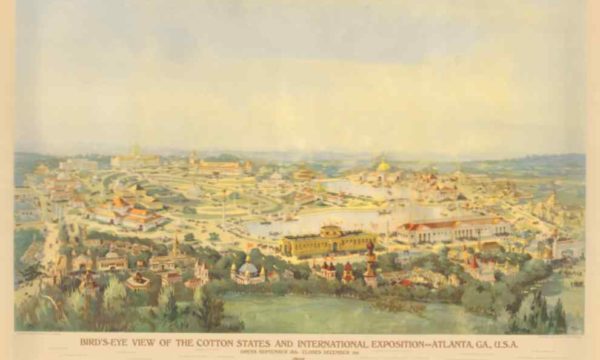
1895 Bird’s Eye of Piedmont Park
In 1895, just 30 years after the Civil War, Atlanta was competing to be a world…Select options This product has multiple variants. The options may be chosen on the product page -
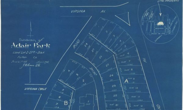
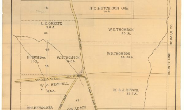
Adair Park
The Adair Park Subdivision map was published in 1916 by O.I. Freedman, a family run engineering…Select options This product has multiple variants. The options may be chosen on the product page -
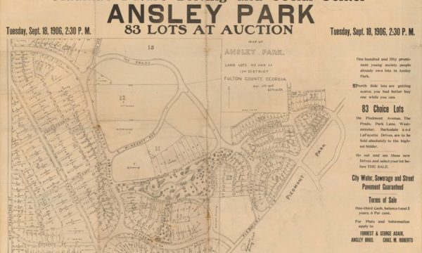
Ansley Park
The Map of Ansley Park was printed in 1906 and covers the southern part of Ansley…Select options This product has multiple variants. The options may be chosen on the product page -
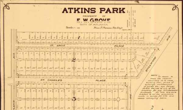
Atkins Park
The Atkins Park Subdivision map was published in 1912 by Knox T. Thomas. This map is…Select options This product has multiple variants. The options may be chosen on the product page -
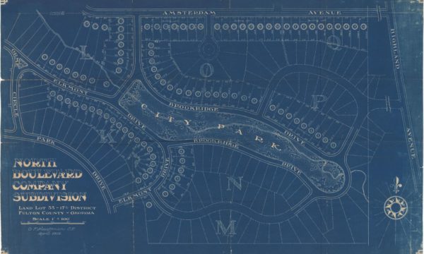
Brookridge Park
The Brookridge Park Subdivision map was published in 1935 by I.U. Kauffman & Sons, a family…Select options This product has multiple variants. The options may be chosen on the product page -
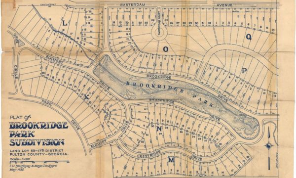
Brookridge Park White
The Brookridge Park Subdivision map was published in 1935 by I.U. Kauffman & Sons, a family…Select options This product has multiple variants. The options may be chosen on the product page -
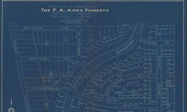
F.A. Ames Subdivision
The F.A. Ames subdivision map in situated on the north side of Virginia Highland. It was…Select options This product has multiple variants. The options may be chosen on the product page -
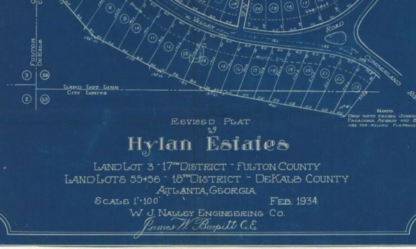
Hyland Estates
The Hyland Estates Subdivision map was published in 1934 by W.J. Nalley, a local civil engineer…Select options This product has multiple variants. The options may be chosen on the product page -
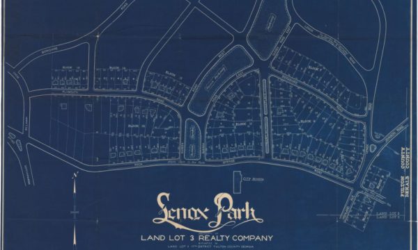
Lenox Park
The Lenox Park subdivision map was published in 1931 by Freeman and Roberts. Land Lot 3…Select options This product has multiple variants. The options may be chosen on the product page -

Morningside North Highlands Virginia Highlands
The Map of Morningside – North Highlands Virginia Highlands was printed in 1926 and covers the…Select options This product has multiple variants. The options may be chosen on the product page -
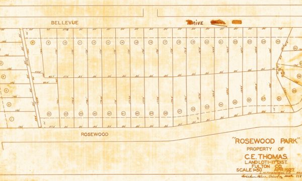
Rosewood Park
Rosewood Park subdivision map was published in 1927 by L.H. Fitzpatrick. It was a later development…Select options This product has multiple variants. The options may be chosen on the product page -
Virginia Highland 1896
Published in 1896 this map represents the area of Atlanta that is known today as Virginia-Highland.…Select options This product has multiple variants. The options may be chosen on the product page -
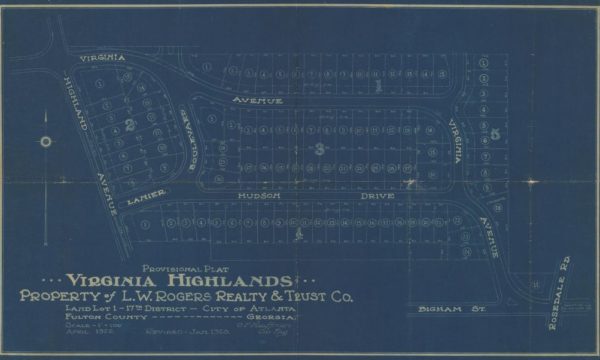
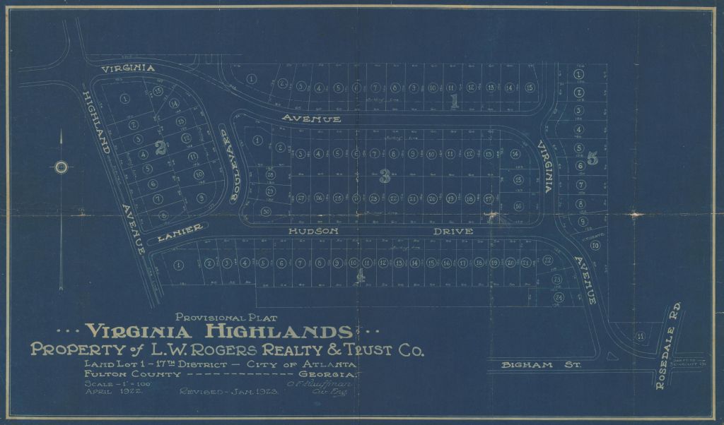
Virginia Highlands
This Virginia Highlands Subdivision map shows the heart of Virginia Highland. It was published by O.…Select options This product has multiple variants. The options may be chosen on the product page